About Us
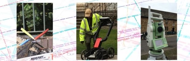
Our intelligent approach to the detection and mapping of underground features enables potential problems and hazards to be identified during the preliminary stages of schemes.
Combining the best of non-invasive geophysical survey technology, with conventional survey techniques, we are able to provide comprehensive underground information. Non-invasive underground mapping surveys are used to detect and map underground hazards and features including buried services, utilities, obstructions and voids.
Based in Hull and providing nationwide coverage, the services offered are proven to make a real difference to Consultants, Contractors and Local Authorities in the delivery of both capital projects and maintenance operations.
Our staff have over 30 years of surveying, ground engineering, and utilities experience in the Construction, Power and Industrial sectors
Underground Mapping is typically carried out to enhance the risk management process, improve hazard plans and avoid damage to existing buried plant/apparatus, personnel and minimise excavation. We provide accurate information on the location of underground features which can enable safer and more practicable design solutions to be acheived.